Yates County Sheriffs Office / February 4, 2026
Arctic Front to Bring Subzero Wind Chills and Gusty Winds This Weekend
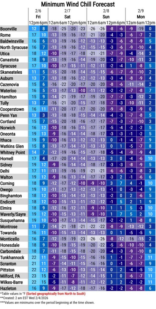
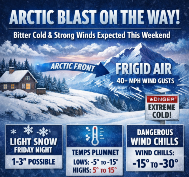
An arctic cold front will move through the region late Friday. While there will be widespread light snow with this system, the main concern will be the bitterly cold conditions following the frontal passage. The coldest temperatures are expected between Friday night and Sunday evening as highs will be in the single digits and teens and lows will be near and below zero. Accompanied with this front will be blustery winds and gusts as high as 40 mph possible. The cold temperatures combined with strong winds will lead to wind chills well below zero. For your convenience, a chart showing the wind chill forecast from noon Friday to noon Monday is attached. At this time, there are no advisories or watches in effect but will likely be needed in future updates.
Questions and reports can be sent to bgm.stormreport@noaa.gov and the NWS Binghamton public phone number is 607-729-1597.